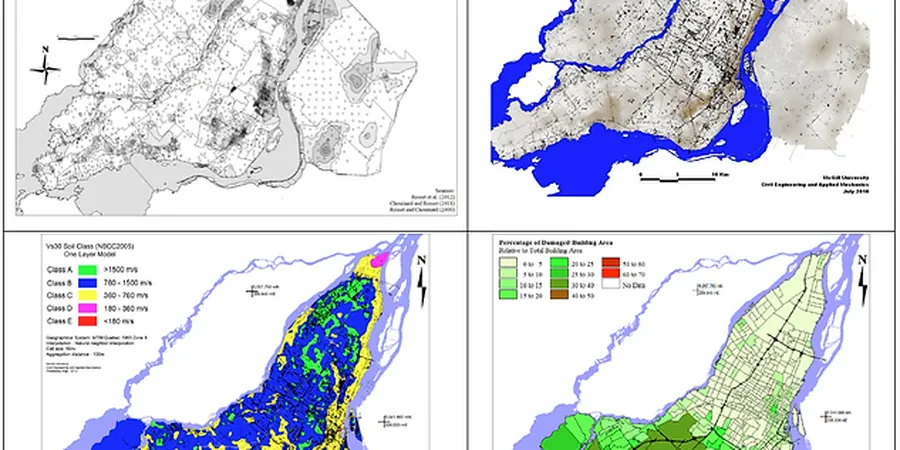
NZS 1170.5 site subsoil classification alone often misses the sharp spatial variations in Christchurch. The 2010-2011 Canterbury sequence proved that two adjacent sections can experience fundamentally different ground motion and damage patterns. A detailed seismic microzonation resolves that. The work combines deep shear-wave velocity profiling, borehole data, and the strong-motion records captured at stations like CBGS and CCCC. The output is not just a site class map — it is a calibrated ground-response model that feeds directly into foundation design. For sites near the Avon River or within the former swamp zones, we integrate CPT testing to capture thin liquefiable layers that standard SPT spacings can miss, and MASW surveys to define Vs profiles down to 30 m and beyond for site period calculation.
Two sites 200 m apart in Christchurch can have a 40% difference in spectral acceleration at 0.5 s — microzonation quantifies that gap.